
Ground-truthing: building a holistic understanding of informal settlement dynamics
4 October 2023
Informal settlements, often characterised by their rapid growth and lack of formal planning, pose unique challenges for community development efforts. Accurate and up-to-date mapping is essential to comprehend the complex dynamics of these communities.
This is a live issue for the RISE program, which is constructing novel, decentralised water and sanitation infrastructure in these dynamic contexts for the first time. Our Build Teams rely on these maps for the design and planning of intervention infrastructure. At the same time, our Research Teams actively maintain ‘live’ maps as spatial data aids used by our field workers to navigate the settlements when collecting human health and environmental samples. This real-time knowledge of settlements enhances RISE’s map accuracy, as well as creating a unique longitudinal dataset of population movement that gives RISE the ability to accurately track participants and sampling locations over time.
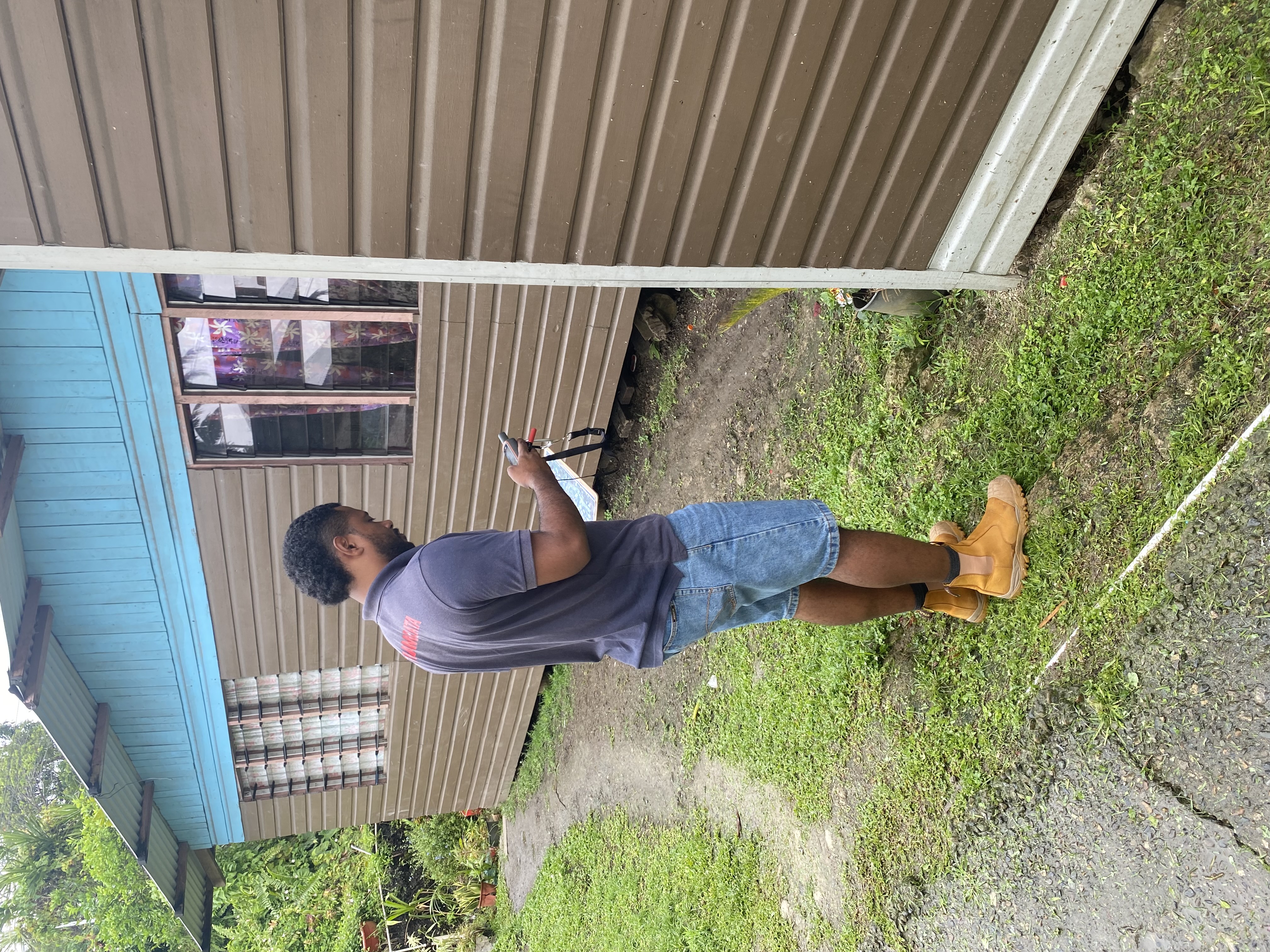
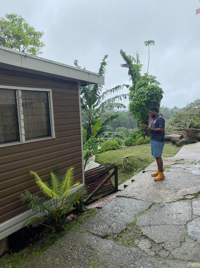
For Maika Nativa, a Data Officer with RISE Fiji, a process called ground-truthing is essential to understand, plan and develop this infrastructure in informal settlements effectively.
"Initially, we used Google Earth to map boundaries and houses,” Nativa explains. “Then, as our Data Team’s skills grew, we transitioned to QGIS. We eventually settled on ArcGIS, an industry-standard GIS software package. We draw roofs and outline access points or landmarks like waterways. These tools are invaluable in our work,” he says.
 Complementing these technical tools, settlement residents bring their invaluable knowledge and lived experience to the mapping process. Nativa says, "In informal settlements, where new structures can pop up without official approvals, constant ground-truthing together with the community is essential to understand the place’s evolution: residents are key to help us understand changes on the ground, like new houses, and if they need to be connected with water services or a toilet.”
When map data and community inputs directly impact our infrastructure plans, collaboration emerges as a linchpin in the process. Nativa explains how sharing findings internally benefits the larger effort. "We began sharing ground-truthing results in 2022 with the Build team, and we have since been conducting regular ‘check-ins’. It has allowed us to align our efforts with the Build team's design work.
“New houses mean increased population, which impacts infrastructure planning,” he says. “The Build team can integrate these changes into their water and sanitation infrastructure designs, ensuring more efficient interventions.”
Meagan Zoing, Design Manager within the RISE Fiji Build team, highlights the significance of this cooperation. "Our design decisions are only as effective as the accuracy of our data,” Zoing says.
"Ground truthing is about cross-referencing maps with actual conditions, particularly in areas where data is not updated online. We pick up the most recent data, document changes and mark significant landmarks.”
The impact also extends beyond the Build team. "It enables our research team to assess environmental conditions, and engage with households on health and wellbeing surveys. It helps RISE make informed decisions on where and how to direct its efforts," says Zoing, referring to RISE’s ongoing program of collecting environmental and human health data to monitor the impacts of the water and sanitation infrastructure in the RISE settlements.
This intricate dance of collaboration between different teams and roles within RISE Fiji is a testament to the effectiveness of their approach. "Understanding each team's needs and roles is key: the Data team supports the Build team, leveraging their expertise to enhance our work. This symbiotic relationship enhances our ability to make informed decisions," Zoing says.
The cross-team collaboration isn't just about sharing findings – it's about building a holistic understanding of informal settlement dynamics. The insights shared by the Data team's ground-truthing efforts aid the Build team in developing more effective designs. Likewise, the Build team's own ground-truthing activities enhance the accuracy of the data collected for research. "We're all interconnected. It's about a shared vision and understanding the real conditions on the ground," Zoing adds.
Personal motivations also play a role in the commitment of team members. Nativa reflects on his journey from volunteering to becoming a Data Officer. "My interest in data grew through my experiences in RISE Fiji. Working with informal settlements pushed me to contribute to meaningful change," he says.
The efficiencies and synergies driven by Nativa, Zoing, and the wider Fiji team underline the crucial role of accurate settlement maps in advancing the RISE project. By bridging the gap between digital data and on-the-ground reality, coupled with collaboration and a shared commitment to enhancing lives, RISE is ensuring that both the research and built infrastructure are firmly tied to the true lived experience of our informal settlement community partners.
Cover image and story image: RISE Fiji Data Officer, Maika Nativa displaying ground-truthing in action.
![]()
![]()
![]()
